WalkNYC
WalkNYC is New York City’s wayfinding system. The system is a collection of maps and signs to help you find your way around the city.
The WalkNYC wayfinding signs are easy to use by pedestrians, cyclists and transit riders. WalkNYC maps and signs use limited text, a clear layout, and universal icons.
Most WalkNYC signs are on sidewalks, at Citi Bike stations or ferry terminals, and inside subway stations. The WalkNYC map design is also used for the NYC Bike Map and NYC & Co.’s Official Map of New York City.
Types of Wayfinding
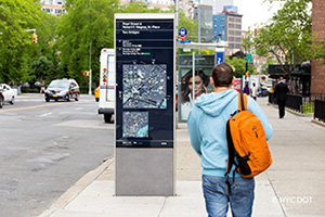
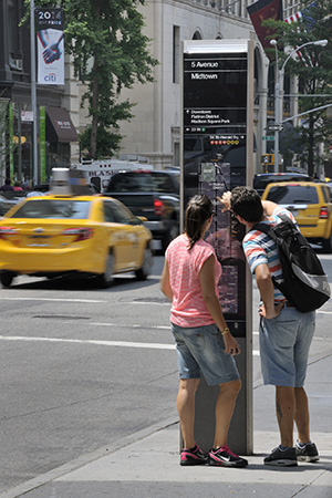
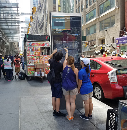
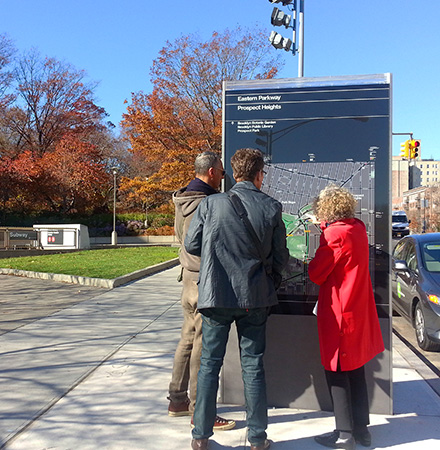
Pedestrian Signs
- Installed on sidewalks and in plazas
- Maps provide neighborhood information, such as street names, mass transit, museums and other neighborhood amenities
- Small, medium, and large signs with maps
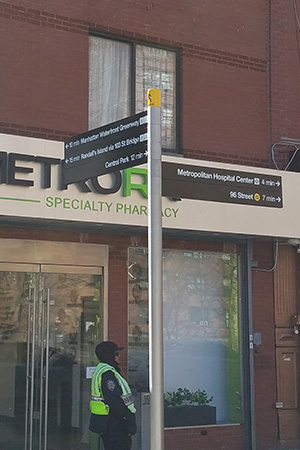
- Fingerpost signs point in the direction of key destinations at locations where maps are not needed
- Developed and maintained by NYC DOT
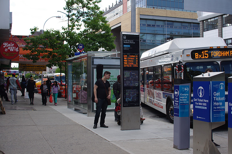
Bus Signs
- Installed at bus stops
- Provide maps and real time bus arrival information on digital displays
- Maps provide bus routes and local neighborhood information
- Developed and maintained by NYC DOT
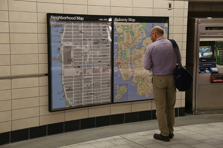
Subway Station Neighborhood Maps
- Located inside subway stations
- Provide the same information as pedestrian maps with lighter colors for indoor viewing
- Developed by NYC DOT
- Installed and maintained by New York City Transit
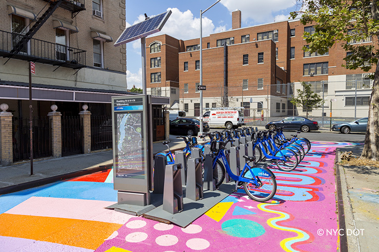
Citi Bike Station Maps
- Located on bike share station kiosks
- Provide a larger map area to show bike lane network and Citi Bike stations
- Developed by NYC DOT
- Installed and maintained by Citi Bike
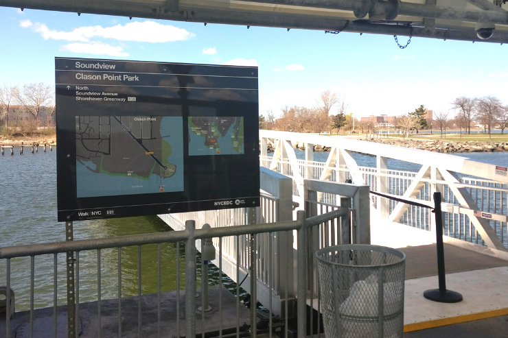
NYC Ferry Maps
- Located at NYC Ferry landings
- Provide the same information as pedestrian maps and includes NYC Ferry shuttle service information, if available
- Developed by NYC DOT
- Installed and maintained by NYC EDC
Map Design
WalkNYC maps use easy-to-understand pictures (icons) to represent important locations on the map. Examples of these include: bathrooms, wheelchair ramps, stairs, libraries, post offices, and playgrounds. The icons help speakers of any language understand the maps.
WalkNYC maps show what you are seeing directly in front of you, and make it quick and easy to understand where you are and what is to the left, right, and behind you as well. This is called “heads-up” mapping.
- All WalkNYC maps show basic information such as:
- “You are here” icons
- Walk times
- Street names
- Major parks
- Major landmarks such as large public buildings, hospitals or museums
- Subway stops, train stations, airports, and ferry landings
- Pedestrian and bicycle routes over bridges or on greenways
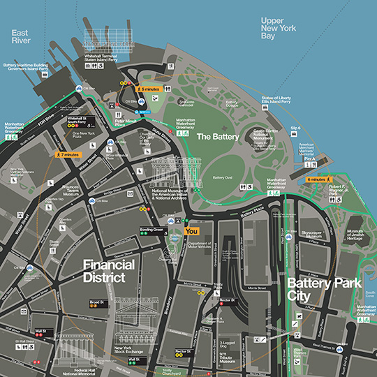
WalkNYC signs usually include two maps - one that shows a smaller distance and one that shows a larger distance.
Smaller Distance WalkNYC Map
- The smaller distance WalkNYC maps show locations that you can walk to within five to seven minutes of the sign.
These maps are helpful for exploring the neighborhood or finding specific locations. Besides the basic information,
these maps also include:
- Building addresses
- Pathways inside parks
- Neighborhood landmarks like schools or statues
- Neighborhood amenities like post offices
- Stairs, ramps and elevators
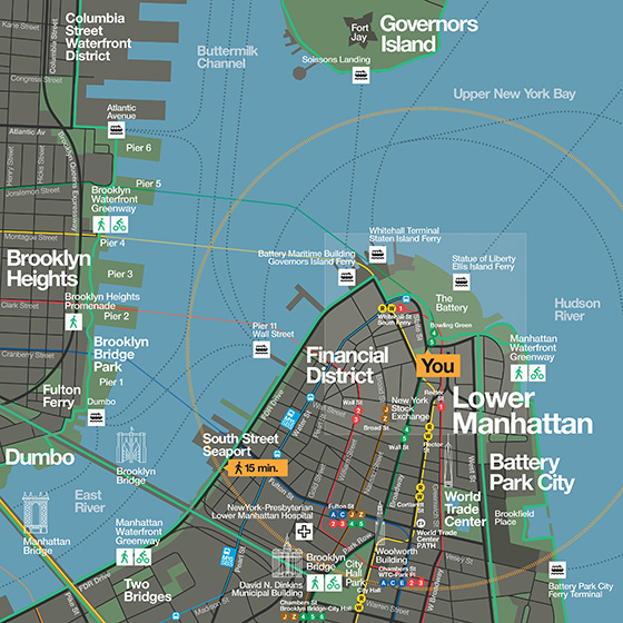
Larger Distance WalkNYC Map
- The larger distance WalkNYC maps show locations that you can walk to within 15 minutes of the sign. They are helpful
for planning longer walks, bike rides, or trips using public transportation. Besides the basic information, these
maps also include:
- Subway routes
- Select Bus Service (SBS) routes
- Surrounding neighborhoods
Sign Locations
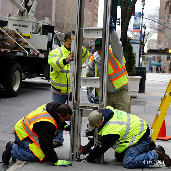
- WalkNYC pedestrian signs are installed citywide on sidewalks and in plazas. Often located in areas that are:
- Busy pedestrian corridors
- Near subway stations and other transportation hubs
- Key decision-making points for pedestrians
- Popular destinations
- Difficult-to-navigate areas
Siting guidelines and placement details are provided in the NYC DOT Street Design Manual: WalkNYC sign specifications General guidelines for installing WalkNYC signs on sidewalks
Report a Problem with a Wayfinding Sign
You can report the following WalkNYC sign conditions:
- Broken, cracked, or missing glass
- Dirty, has graffiti, or stickers
- Loose or leaning
- Incorrect map or information
- Fingerpost issue