Street Activity Sensors
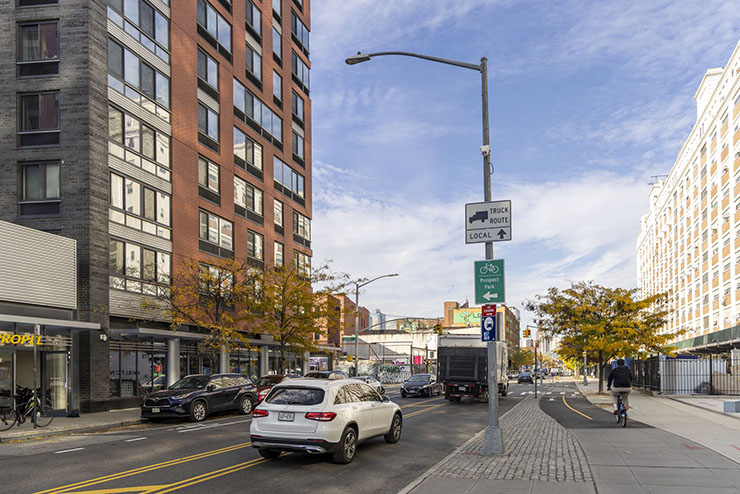
NYC DOT is using cutting-edge street activity sensors to better understand how people use NYC streets and inform safer street design. Street activity sensors are small devices typically mounted onto streetlight poles. The sensors operate continuously, capturing changes in travel patterns by time of day, season, and street design.
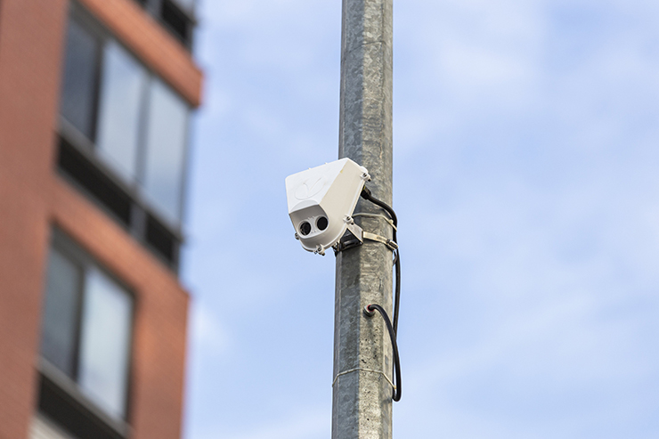
Designed with privacy as a core value, video footage is processed in real time and immediately discarded, with only anonymous data retained. The data does not include identifying information about the roadway’s users. Faces and license plates are deliberately obscured in any video footage.
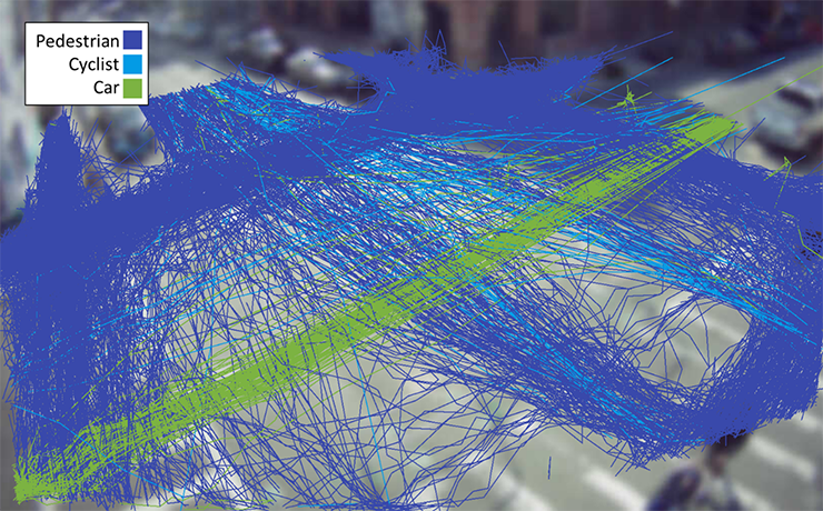
By analyzing detailed data on how streets are used, the agency uses the sensors to:
- Evaluate the effectiveness of street redesigns and safety projects
- Identify high-risk locations by interactions between users
- Better allocate street space among pedestrians, cyclists, and vehicles
- Improve access to transit, loading zones, and local businesses
- Measure volume trends and changes over time, across the city
Data Collection
Traditionally, NYC DOT collects much of its traffic counts manually by reviewing video of traffic and counting the different modes during a specific timeframe. This process limits the duration and types of data that are collected.
Data collected by these sensors includes counts of different types of road users, paths of travel, and travel speeds. For example, the sensors can identify areas where pedestrians are crossing mid-block instead of at crosswalks. This helps the agency identify locations where a mid-block crosswalk would be beneficial. Counts include cars, trucks, bicycles, scooters, buses, pedestrians, and more.
Locations
NYC DOT is installing up to 100 sensors in a variety of locations around the city. From roads primarily serving vehicles to pedestrian priority areas, the variety of areas will help the agency understand travel patterns across the city.