
 Environmental Protection311Search all NYC.gov websites


Schoharie Reservoir
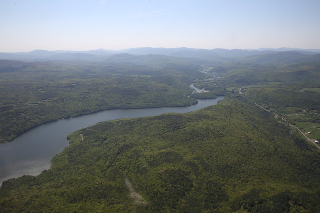
Located at the intersection of Schoharie, Delaware and Greene Counties, about 36 miles southwest of Albany and roughly 110 miles from New York City, Schoharie Reservoir is formed by the damming of the Schoharie Creek. Schoharie Creek continues north and eventually drains into the Mohawk River, which flows into the Hudson north of Albany. Schoharie Reservoir consists of one basin, almost 6 miles in length and holds 17.6 billion gallons at full capacity. It was placed into service in 1926.
Schoharie Reservor is one of two reservoirs in the City’s Catskill system, and the northernmost reservoir in the entire water supply system. Schoharie Reservoir receives a very large quantity of water for a small reservoir. Consequently, water stays in the reservoir for only a short time before it is drawn into the Shandaken Tunnel and travels southeast 18 miles, where it enters Esopus Creek at the Shandaken portal in Ulster County. It flows another 11 miles down Esopus Creek into Ashokan Reservoir for longer-term storage and settling. When it leaves Ashokan Reservoir, it is carried southeast under the Hudson River via the 92-mile Catskill Aqueduct. It ordinarily makes its way to the Kensico Reservoir in Westchester for further settling and mixing with Delaware system water, before moving down aqueducts to the Hillview Reservoir in Yonkers and entering New York City’s water supply distribution system.
The Schoharie watershed’s drainage basin is 316 miles and includes parts of 15 towns in three counties: Ashland, Cairo, Durham, Halcott, Hunter, Jewett, Lexington, Prattsville and Windham in Greene County; Broome, Conesville, Gilboa and Sullivan in Schoharie County; and Roxbury and Stamford in Delaware.
Download a Map of Schoharie Reservoir. For more information about New York City’s water supply system, visit Water Supply.