
 The Mayor's Office for Economic Opportunity311Search all NYC.gov websites


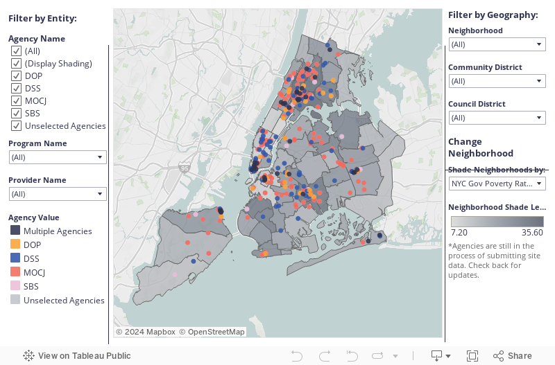
Social Service Site Location Data
THE SOCIAL SERVICE LOCATION DATA PROJECT
As part of the City’s transparency efforts, the Social Service Site Location Data project is publicly releasing datasets and maps of verified locations for contracted social service delivery sites managed by a number of City agencies.
TARGET AUDIENCE
Anyone interested in how social services are distributed throughout New York City, in particular:
- Government
- Advocates
- Academics
PROJECT WEBSITE
Verified Locations for NYC City-Funded Social Services Contracts
PROJECT PARTNERS
9+ City Agencies (to date: ACS, DFTA, DOHMH, DOP, DSS, DYCD, MOCJ, MOCS, SBS)
KEY FEATURES
Relational Database
A relational database has been released on OpenData for public use. Each location, service provider, type of service provided, and NYC agency is given a unique identifier that can be used to link the datasets together.
The service location is given as:
- Latitude And Longitude
- Borough-Block-Lot
- Building Identification Number
- Community District
- City Council District
- Neighborhood Tabulation Area
- Census Tract
For more information on location data and mapping resources, please visit Bytes of the Big Apple, which can be found on the Department of City Planning’s website.
NOTE: Not every entry has data for each location type, as some site locations are sensitive information.
BACKGROUND ON THE SOCIAL SERVICE LOCATION DATA PROJECT
The City is dedicated to publicly releasing its data to be more transparent. In addition, the City committed to making it easier to discover what social services exist and where they are delivered in OneNYC. This project supports the City’s commitment to making government more transparent, and making social service data more accessible.
The data was initially accessed through HHS Accelerator, CheckbookNYC, or from agencies themselves. Agencies confirmed which contracts were for social services, and provided missing data or verified existing data. The site addresses were geocoded, and the data was reformatted and uploaded to Open Data.
This project began with the collection of 2018 data. To view the 2018 map, click here
TECHNOLOGY POWERING THE SOCIAL SERVICE LOCATION DATA PROJECT
The datasets are stored on and accessible through Open Data, the City’s public-facing data portal. This project used the Human Services Data Specification with some modifications to organize the data.
READ MORE ABOUT THE SOCIAL SERVICE SITE LOCATION DATA PROJECT
NYC Government Publishing Open Data for Municipally-contracted Service Providers
Blog Post | Open Referral | 11.8.2018
CONTACT US
Please email our team at Opportunity@cityhall.nyc.gov