
 Department of City Planning311Search all NYC.gov websites


Cromwell Avenue - Jerome Avenue Transportation Study
As a part of the Jerome Avenue Neighborhood Study, DCP’s transportation division completed a transportation study in August 2016. The study analyzed the street network, traffic circulation, safety and operations in the area around Cromwell Avenue and Jerome Avenue in the Bronx.
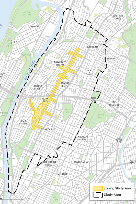
The Cromwell Avenue-Jerome Avenue Transportation Study focused on an area that spans Bronx Community Districts 4 and 5. It runs from 167th Street to 184th Street along Jerome Avenue, reaching as far west as Cromwell Avenue and Edward L. Grant Highway, and as far east as the Grand Concourse. The Cross Bronx Expressway bisects the study area, connecting to Manhattan and New Jersey to the west and Connecticut to the northeast.
The goal of the study was to identify locations with problematic transportation conditions and provide recommendations for improvements to circulation, mobility, safety and access for pedestrians, bicyclists and vehicles. This included identifying key intersections and corridors for detailed traffic analysis, enhancements to the pedestrian experience and street safety improvements.
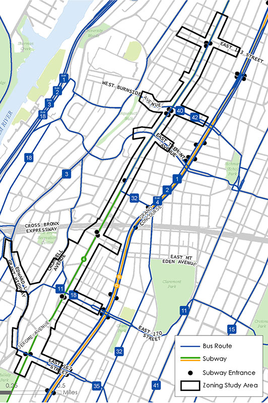
In addition, the public transportation network was examined with a focus on efficiency, access and connectivity. Other components of the project included examining opportunities for streetscape improvements, enhancing access to public spaces and improving existing industrial and commercial corridors. The study also undertook an inventory of off-street parking facilities to identify any potential capacity constraints.
Targeted community outreach effort for this study was part of the planning process and included a neighborhood walking tour and two transportation focus groups with Community Boards 4 and 5.
A series of recommendations was developed to improve the safety and efficiency of transportation in the study area for all roadway users. Some notable recommendations include the following:
- Create a more walkable and livable streetscape that is safe for all roadway users including additional plaza space. Specific locations were targeted along a number of roadways including Jerome Avenue, 167th Street, 170th Street, Edward L. Grant Highway, Plaza Drive and Macombs Road.
- Improve access and connections to subway stations and bus stops with changes to street geometry or station location at key sites.
- Develop and explore opportunities to improve the space under the elevated rail line on Jerome Avenue.
- Improve east-west access for cyclists along 170th Street and Edward L Grant Highway including enhanced connections to the High Bridge and the waterfront area.
- Install additional traffic control measures where needed with new curb extensions, signage, pavement markings, and a new signalized intersection.
The Department of City Planning will continue to work with City agencies including the New York City Department of Transportation, the New York City Department of Parks and Recreation and the Metropolitan Transportation Authority toward implementation of the recommendations. Ongoing community consultation will be essential as this process progresses.
Implementation will focus on identifying high-priority projects that can be implemented in the short-term as well as projects that require a longer-term investment. As plans advance, the City may look to multiple agencies’ capital and operating budgets to implement recommendations, as well as funds from Borough Presidents and City Council members, and the recently-established Neighborhood Development Fund.