Department of City Planning311Search all NYC.gov websites


New York City: A City of Water
Post from RICOH THETA. - Spherical Image - RICOH THETA
New York City has 520 miles of waterfront—that’s longer than Miami, Boston, Los Angeles, and San Francisco combined! The Department of City Planning is currently engaged in developing the next Comprehensive Waterfront Plan; published every ten years, the plan serves as a guide for the development of our City’s waterfront over the next decade.
What do you want NYC’s Waterfront to look like in 2030? Tell us!
We want to hear your ideas for the future of NYC’s Waterfront- join us at one of our upcoming events, and help shape our Waterfront!
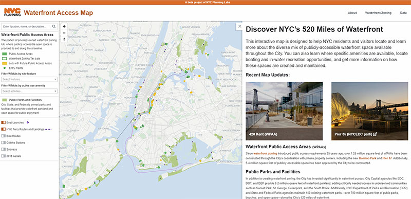
This interactive map is designed to help NYC residents and visitors locate and learn more about the diverse mix of publicly-accessible waterfront space available throughout the City. You can also learn where specific amenities are available, locate boating and in-water recreation opportunities, and get more information on how these spaces are created and maintained.