
 Landmarks Preservation Commission311Search all NYC.gov websites


Maps
Discover NYC Landmarks
This map displays individual, interior, and scenic landmarks, as well as historic districts in all five boroughs. The map also provides detailed building-by-building information for all buildings within historic districts. Users can click on designated buildings and sites for additional information such as building information, photos and designation reports. Click the legend icon on the left of the map screen to identify properties that are color-coded by landmark type.

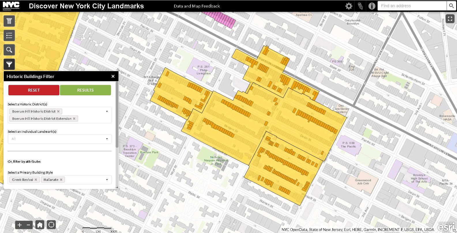
Discover NYC Landmarks (Beta Version)
This enhanced version of the Discover NYC Landmarks map has additional features such as a new historic buildings filter feature that allows users to search buildings by style, architect/builder and building type or era of construction, and the ability to display the results as lists, hyperlinked to detailed profiles on each structure, as well as visually on the map.
As this is in beta mode, meaning it may have some glitches and could be improved, LPC encourages users to provide feedback on how to improve its functionality and use as a public information tool. All feedback and comments should be submitted via info@lpc.nyc.gov or the agency's data and mapping feedback portal. While the map continues to be in beta mode, LPC recommends continued use of the original Discover NYC Landmarks map for official purposes.
Historic District Maps
Historic District Maps are drawn to conform to the the New York City basemap (NYCMAP). The address ranges shown on the maps are based on data available at the time the map was drawn. Please use the Discover NYC Landmarks map above to confirm whether a particular property is within the boundaries of a historic district. If you have additional questions, you may contact our Public Information Officer at 212-669-7817.