
 Lower Manhattan Coastal Resiliency311Search all NYC.gov websites

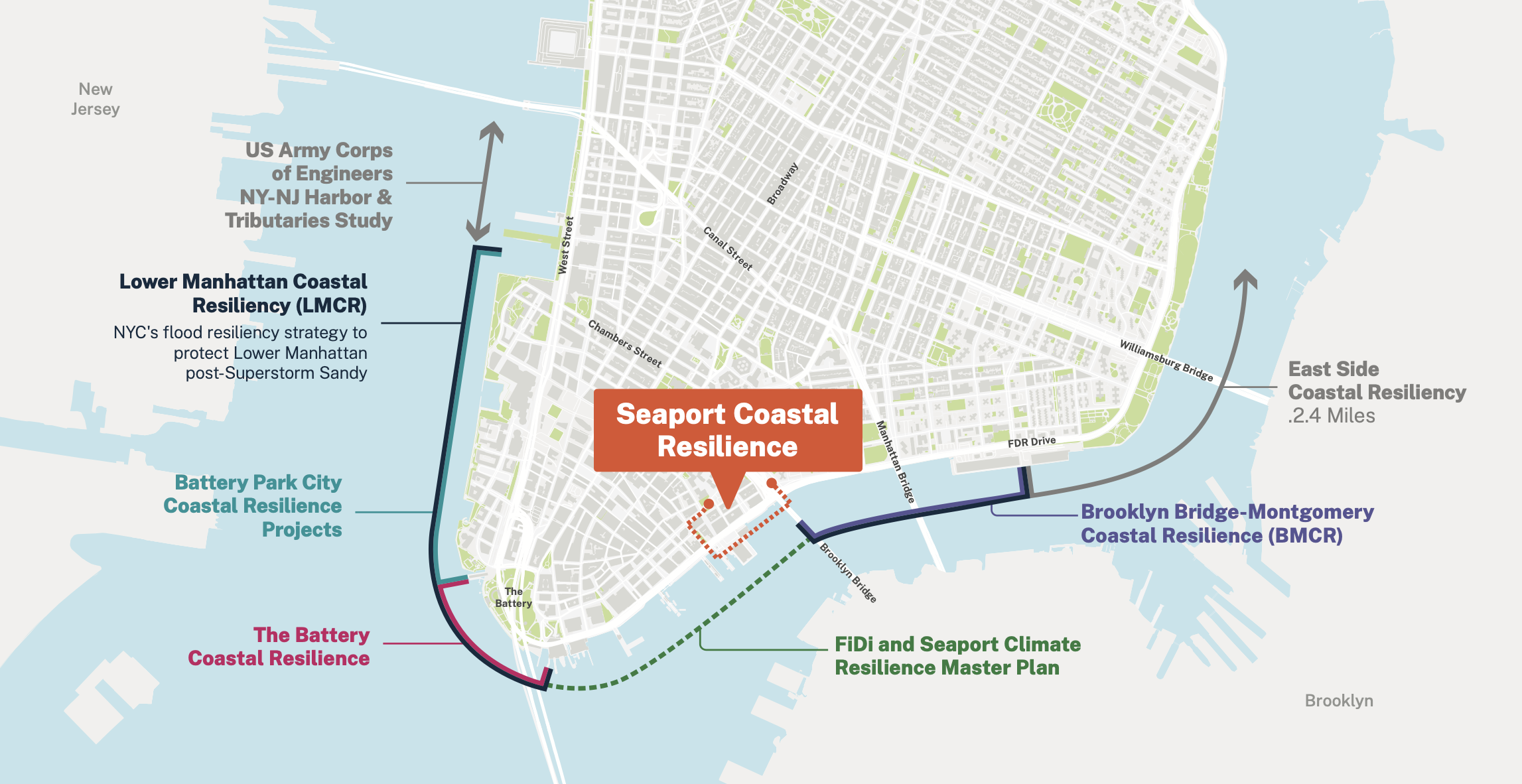
Seaport Coastal Resilience

Seaport Coastal Resilience
Welcome to the Seaport Coastal Resilience Project!
Join us for a Walking Tour!
Date: Wednesday, May 14, 2024
Time: 4:30 p.m. – 6:00 p.m.
Register: bit.ly/SPCR-register-0525
Join us on a walking tour of the project area to learn about project opportunities, challenges, and constraints from the project team, and to share your knowledge and feedback. Space is limited and registration is required so sign up now!
Overview
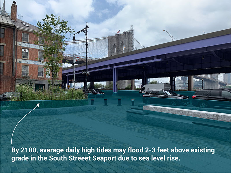
The Seaport Coastal Resilience Project (SPCR) focuses on safeguarding the Seaport neighborhood between John Street and the Brooklyn Bridge (see the image below) from immediate and future risks from tidal flooding and sea level rise projected for the year 2100. To achieve this goal, the project aims to raise the affected waterfront to 11 feet above sea level.
SPCR is being led by New York City Economic Development Corporation (NYCEDC) in coordination with the Mayor's Office of Climate and Environmental Justice and the Bureau of Coastal Resilience at the New York City Department of Environmental Protection. The project began in 2024 and has an anticipated completion date of 2028.
Lead: NYCEDC, MOCEJ
Funding: $228.8M
Timeline: 48 months from Design Contract to Construction Completion