Lower Manhattan Coastal Resiliency311Search all NYC.gov websites

The Financial District and Seaport Climate Resilience Master Plan

The Financial District and Seaport Climate Resilience Master Plan
NYCEDC and Mayor's Office of Climate and Environmental Justice (MOCEJ) released the Financial District and Seaport Climate Resilience Master Plan, a blueprint for comprehensive flood defense infrastructure to protect Lower Manhattan from the urgent threat of climate change. The plan, projected to cost $7 billion, reimagines the shoreline of Lower Manhattan and creates a 21st Century resilient waterfront to withstand severe coastal storms and rising sea levels, which together pose a serious threat to the low-lying Financial District and South Street Seaport neighborhoods where close to a million people work, live, and commute through.
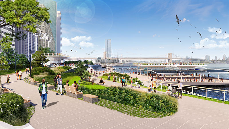
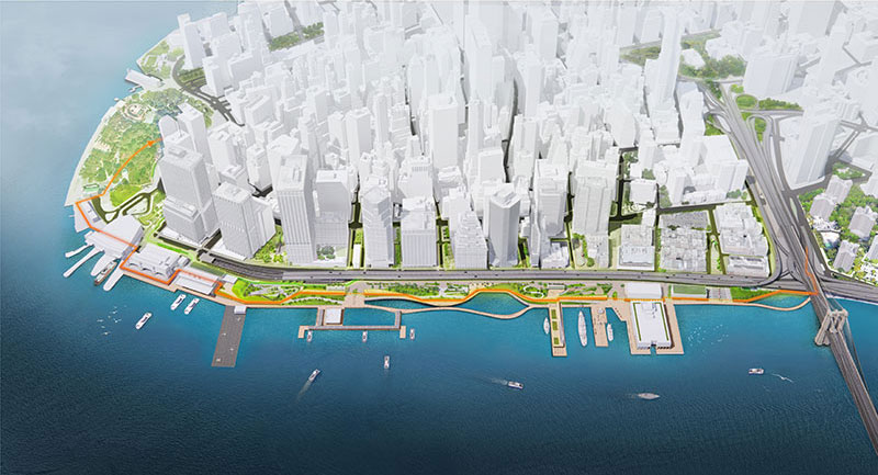
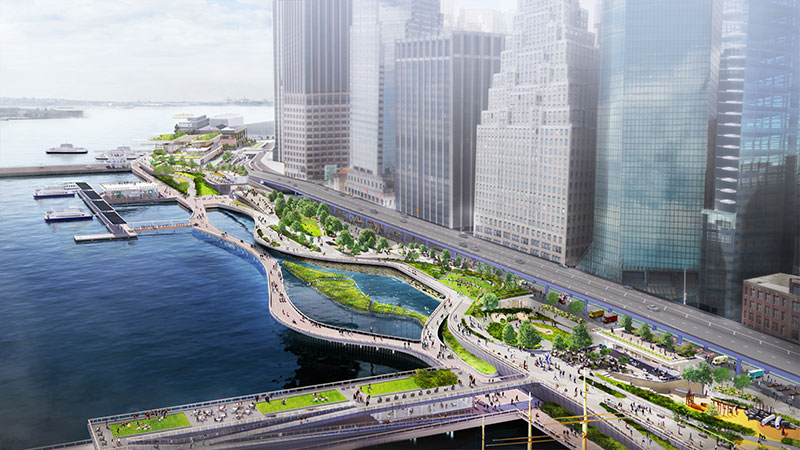
To protect the area, which was hard-hit by Hurricane Sandy in 2012, the plan features a multilevel waterfront that extends the shoreline of the East River by up to 200 feet (approximately one city block) from its existing location. The upper level will be elevated by about 15 to 18 feet to protect against severe storms like Sandy, while doubling as public open spaces with sweeping views of the city and harbor. The lower level will be a continuous waterfront esplanade, raised three to five feet to protect against sea level rise while connecting New Yorkers to the water's edge. When implemented, this innovative design will prevent $11 billion in economic losses to the city and region and protect Lower Manhattan from rising sea levels and more frequent and intense coastal storms.
The plan encompasses almost one mile of waterfront from The Battery to the Brooklyn Bridge. Notable features of the plan include:
- A raised shoreline with floodwalls buried in the landscape that will permanently protect Lower Manhattan from coastal storms and creating new open spaces with expansive views
- Resilient stormwater infrastructure, including a new pump station and green infrastructure
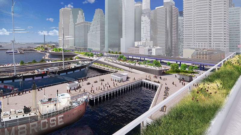
- Resilient ferry terminals for Staten Island, Governors Island, and NYC Ferries, among other operators
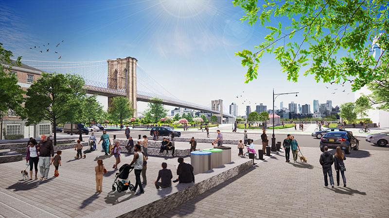
- Universally accessible entrances and pathways, designed to ensure people of all ages and abilities can get to and move around the waterfront
- New public open spaces that provide seating and space for activities.
- Space for habitat restoration and provide opportunities to learn about the ecology of the East River
- Resilient piers for docking historic ships, bolstering the historic character of South Street Seaport
The City has worked and continues to collaborate closely with the community to shape this plan. Through numerous public meetings and workshops, an online engagement portal, youth outreach with local schools, and other creative forms of outreach, the City incorporated feedback at every step along the way. To maximize engagement, the City also formed the Climate Coalition for Lower Manhattan, a group of local and citywide stakeholders chaired by Shaun Donovan, CEO and President of Enterprise Community Partners; Elizabeth Yee, Executive Vice President and Chief of Staff at The Rockefeller Foundation; and Tammy Meltzer, Chairperson of Manhattan Community Board 1.
To learn more and download the full report, please visit fidiseaportclimate.nyc.