NYC Housing Recovery311Search all NYC.gov websites

Data & Maps

Data & Maps
Data
Sandy Funding Tracker
This Sandy Funding Tracker site tracks New York City’s response to Hurricane Sandy. The disaster caused more than $19 billion in damage and lost economic activity, disrupted critical infrastructure systems, and destroyed or seriously impacted thousands of homes and businesses.
On this site you will find performance metrics, information on New York City’s use of federal recovery funds, and maps showing recovery activities in your neighborhood.
Maps
The best offense is a good defense. The best way to prepare for any event is to educate yourself on what to expect.
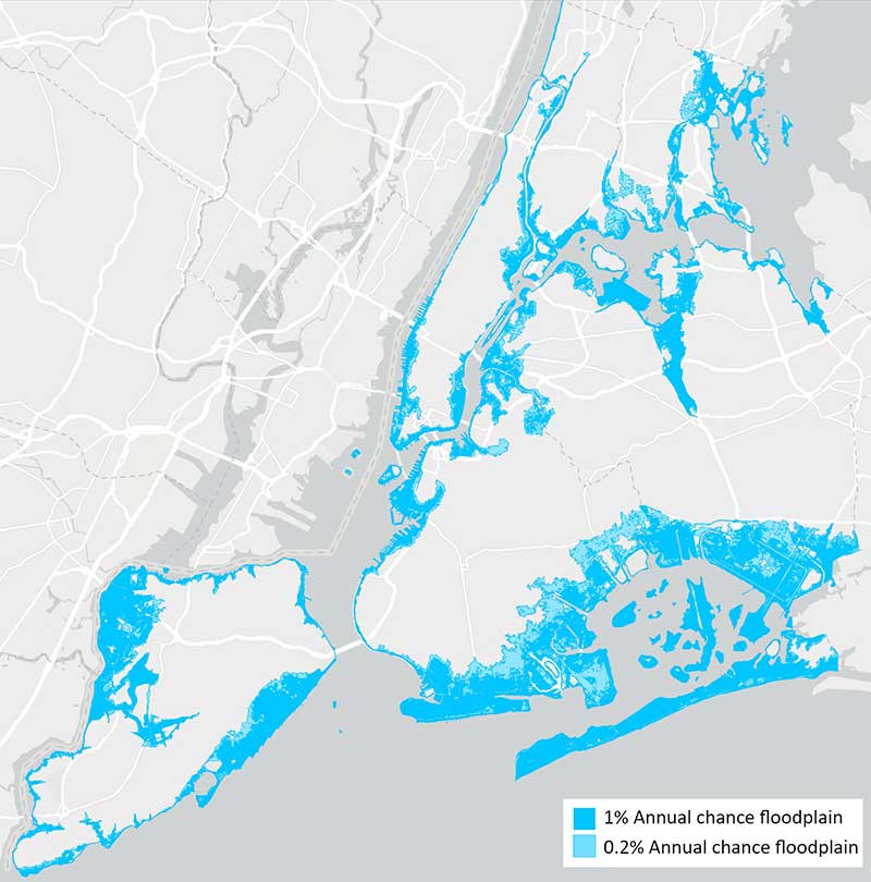
NYC Flood Maps
New York City’s flood risk is changing. Many more New Yorkers will be considered exposed to flood risk, and, if they have federally backed mortgages, they will be required to buy flood insurance.
FloodHelpNY, a project of the Center For NYC Neighborhoods in partnership with NYC and NYS agencies, helps New Yorker’s understand their flood risk and flood insurance requirements.
The NYC Flood Hazard Mapper is a tool from the NYC Department of City Planning that shares an overview of the coastal flood hazards facing the city. It shows areas at risk of flooding today and in the future and is intended to support informed decision-making for a variety of audiences.
FEMA Maps
FEMA Flood Map Service Center: Search By Address