 Department of City Planning311
 Search all NYC.gov websites
Press Releases
For Immediate Release
April 11, 2019
Contacts:
Rachaele Raynoff, Joe Marvilli – press@planning.nyc.gov (212) 720-3471
New Tool: DCP Automates Production of Maps for Land Use Applications
NEW YORK – Department of City Planning (DCP) Director Marisa Lago today announced the release of the Applicant Maps Tool, that allows the public and land use applicants to easily understand and produce land use maps online at no charge.

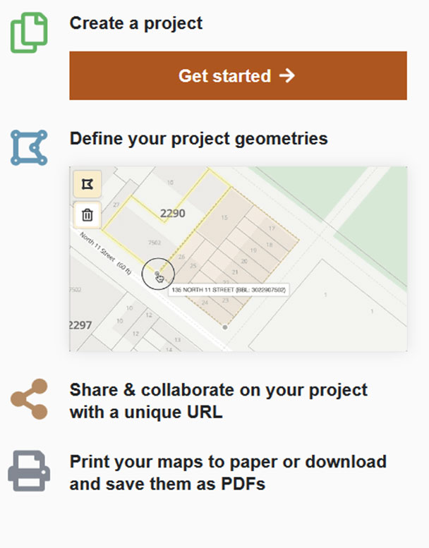
The digital map tool is the latest in a series of web products aimed at increasing transparency and access to New York City’s land use process, rules and data. It automatically pulls in relevant zoning and geographic information from multiple City data sources needed to create an area map or land use map, which is required for most land use applications.
“DCP’s newest digital mapping tool makes it easy to produce a professional land use map. This will streamline the public review application process, especially for smaller property owners, and continues DCP’s push to make land use tools more accessible to regular New Yorkers,” said DCP Director Marisa Lago.
Until now, producing an area map has been costly, requiring specialized Geographic Information System (GIS) skills and software. By contrast, DCP’s new, free self-service tool helps lower the barrier to entry for public review.
The applicant map tool helps to level the playing field for the public and smaller property owners and developers by allowing them to easily build quality land use maps with needed details, such as existing zoning as well as proposed zoning changes, neighboring land uses and street dimensions. These maps are needed when applying to the City Planning Commission for zoning changes.
Once the user selects a site, typically one or more tax lots, the tool adds layers of associated tax lot info, zoning and land use information to the map. The tool increases accuracy, clarity, ease of review and updating, resulting in a more streamlined and efficient application process and materials that are easier for the public to read when reviewing land use applications.
DCP will continue to add additional maps that are required for applications, as well as new features and improvements based on user demand and feedback.
Other DCP digital tools include:
- The Zoning Resolution online – a free, searchable digital platform that makes New York City’s official Zoning Resolution instantly accessible to New Yorkers.
- NYC Population Factfinder – powerful map search that enables users to easily define study areas within New York City and examine detailed population characteristics and how these have changed over time.
- Zoning Application Portal (ZAP) - offers the status of active land use applications and project data back to 1970.
- Community Portal – DCP’s gateway to data, maps and other resources describing New York City’s 59 community districts.
- ZoLa– The zoning and land use map that provides a simple way to research zoning regulations, find the zoning for a property, discover new proposals in a neighborhood and learn where DCP initiatives are happening throughout the city.
- Facilities Explorer – A comprehensive dataset of public and private facilities and program sites that shape the quality of city neighborhoods. Find libraries, parks, schools, health and social service providers, Privately Owned Public Spaces (POPS) and much more.


