
 Office of Environmental Coordination311Search all NYC.gov websites


2020 Technical Manual
Outdated – DO NOT USE
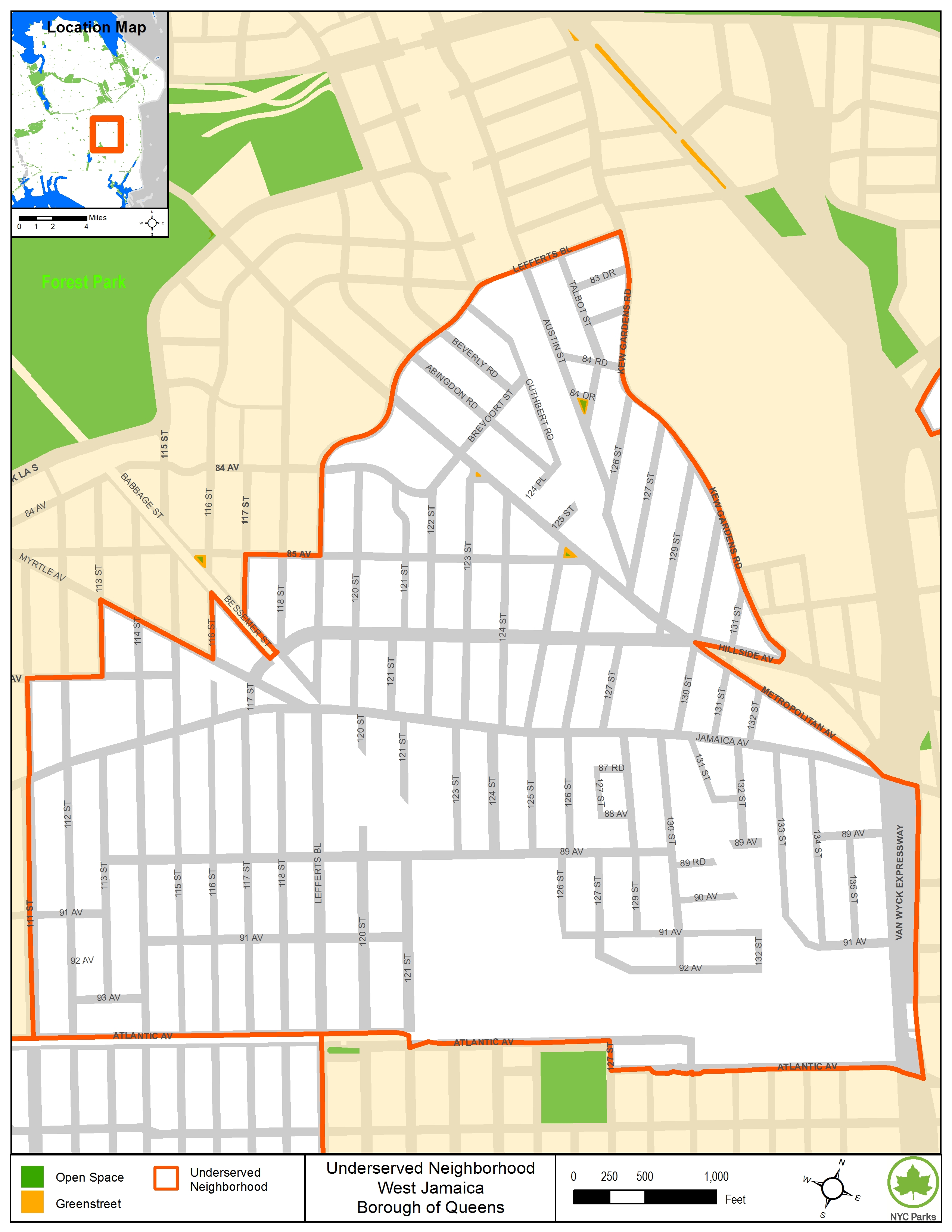
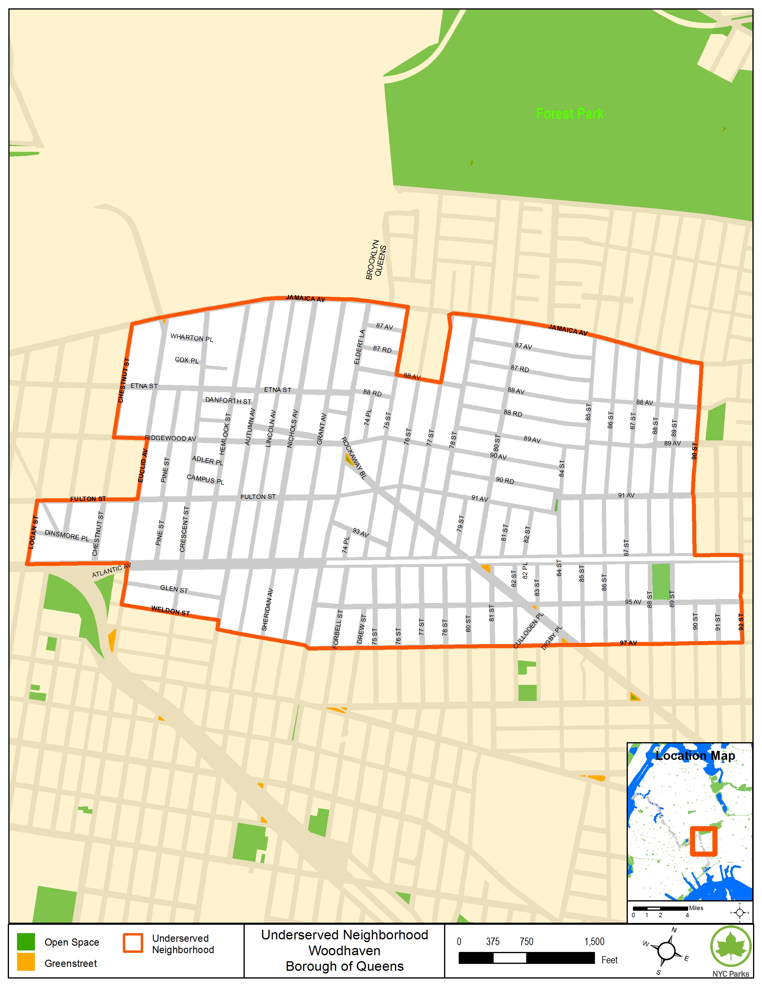
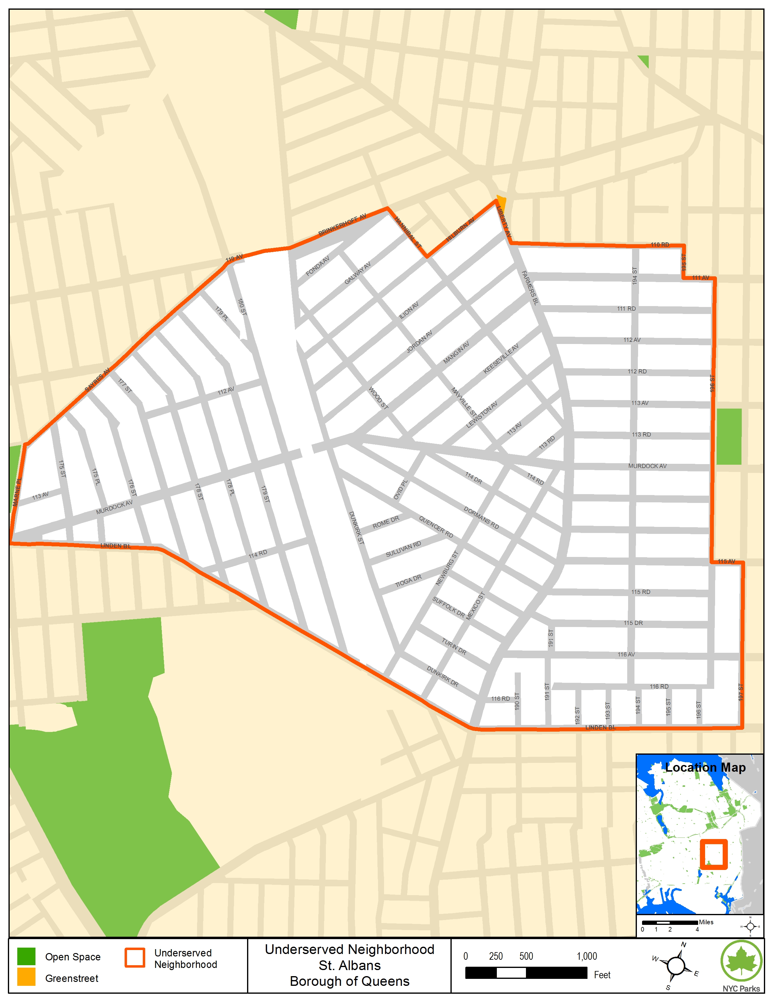
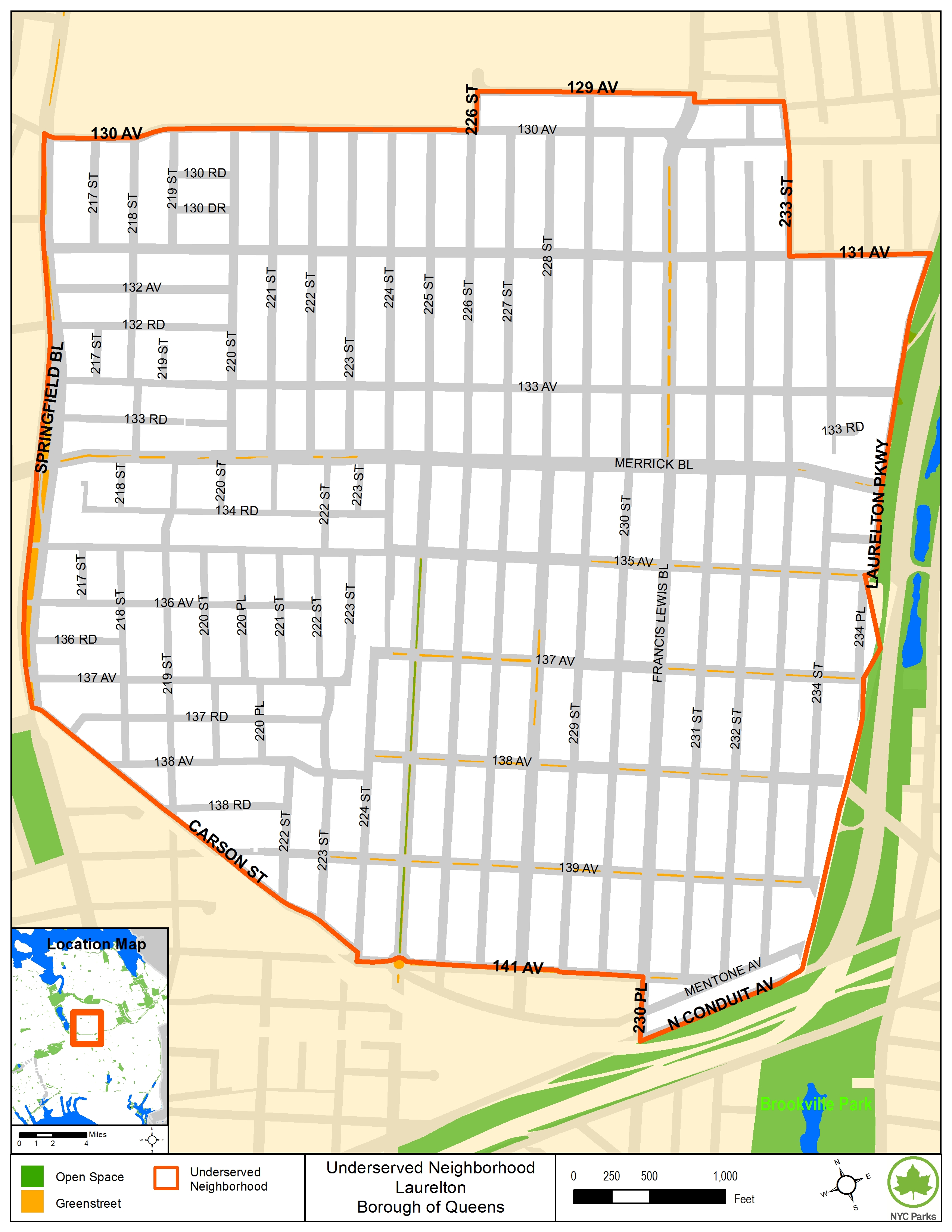
Open Space Map - Queens
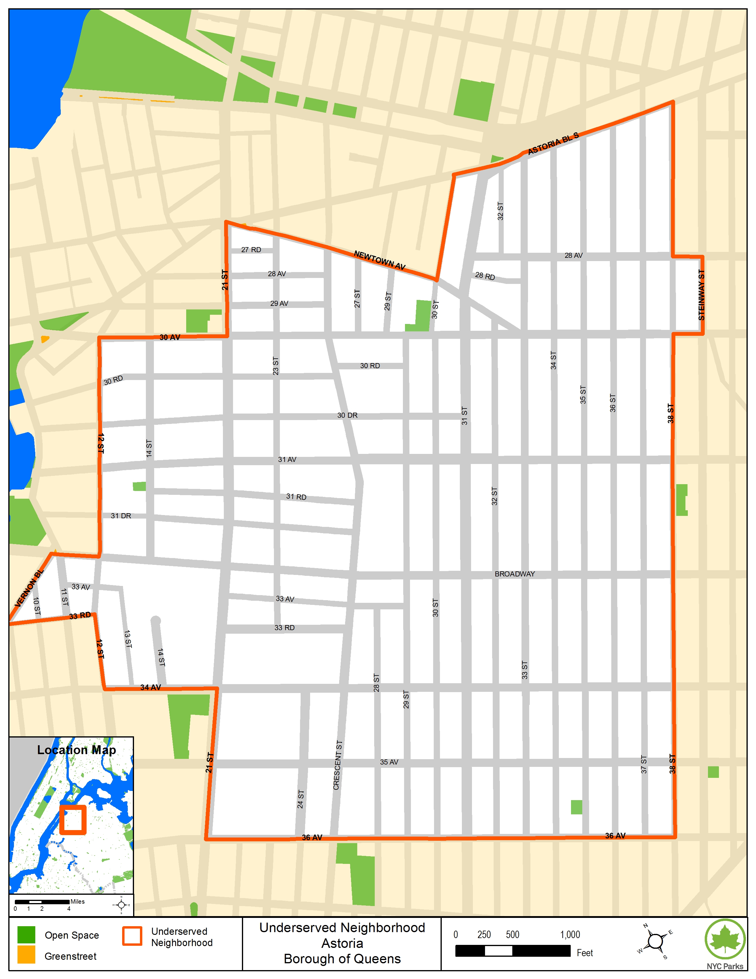
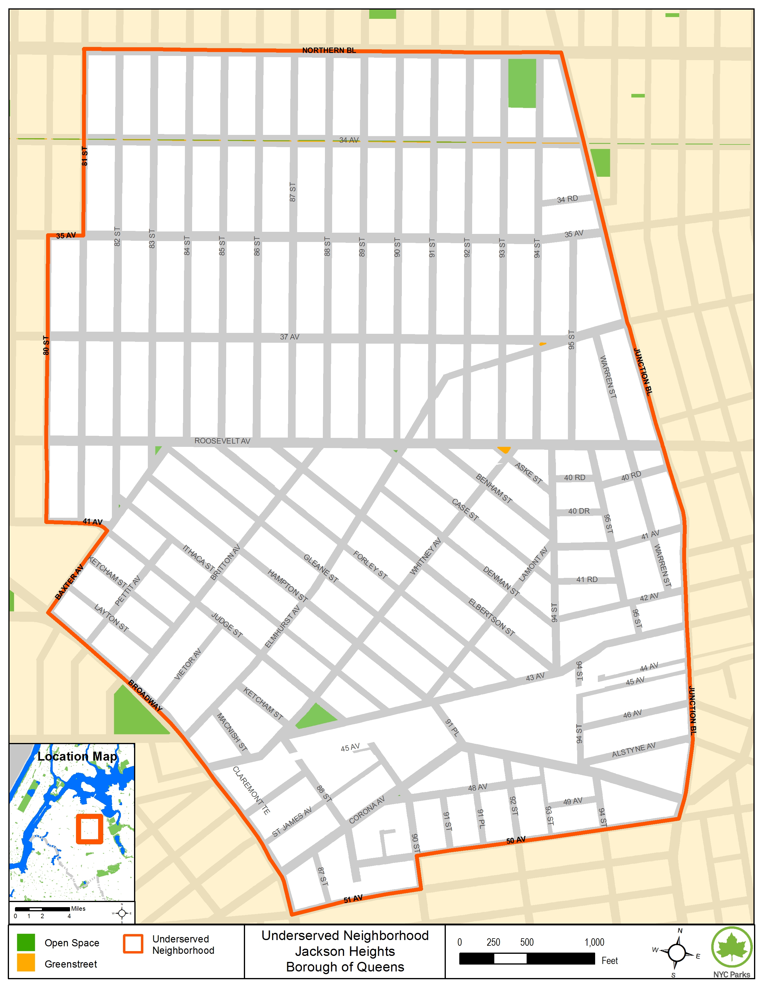
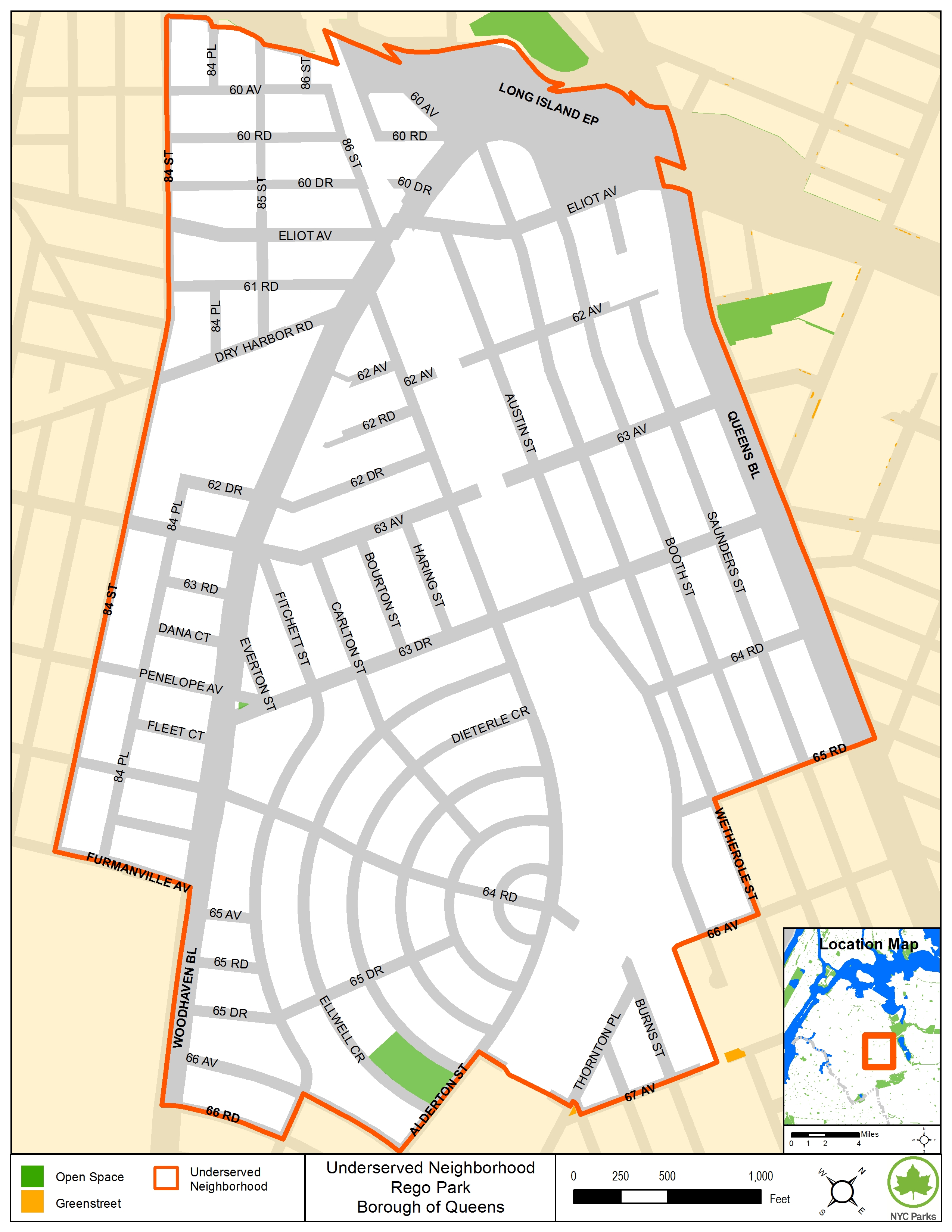
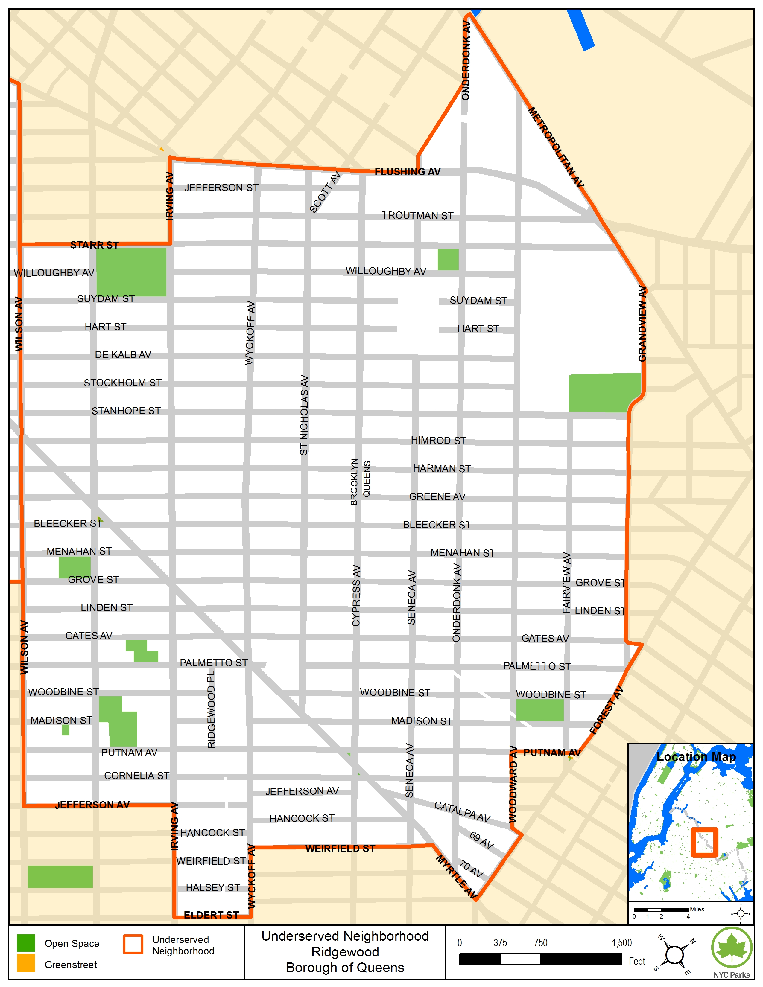
Below are maps outlining the areas identified as underserved or well-served by open space for each community district in Queens. Some community districts contain both underserved and well-served areas, while others do not have any underserved or well-served open space areas.
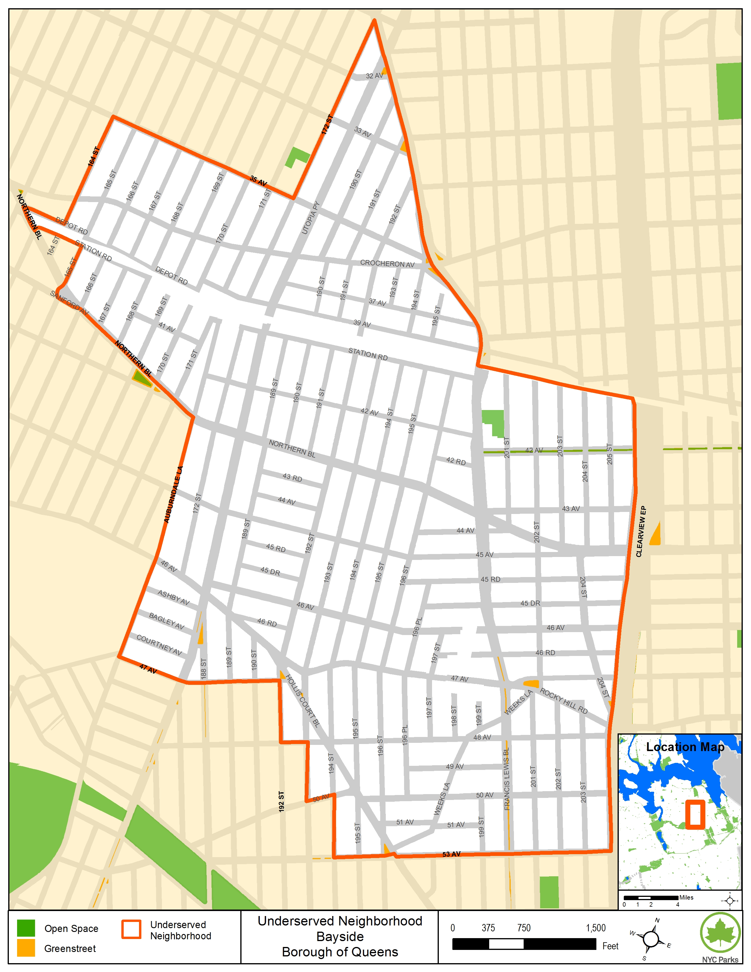
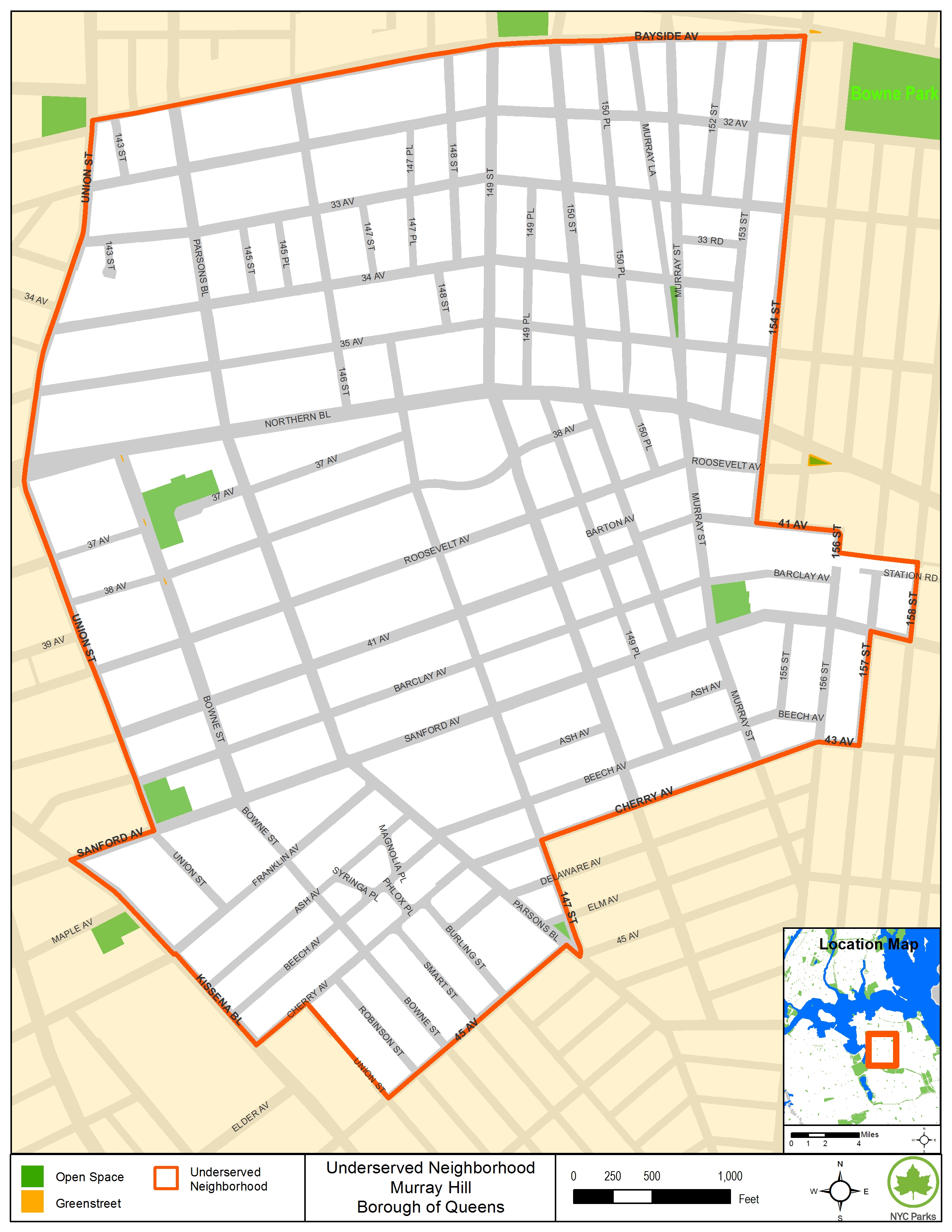
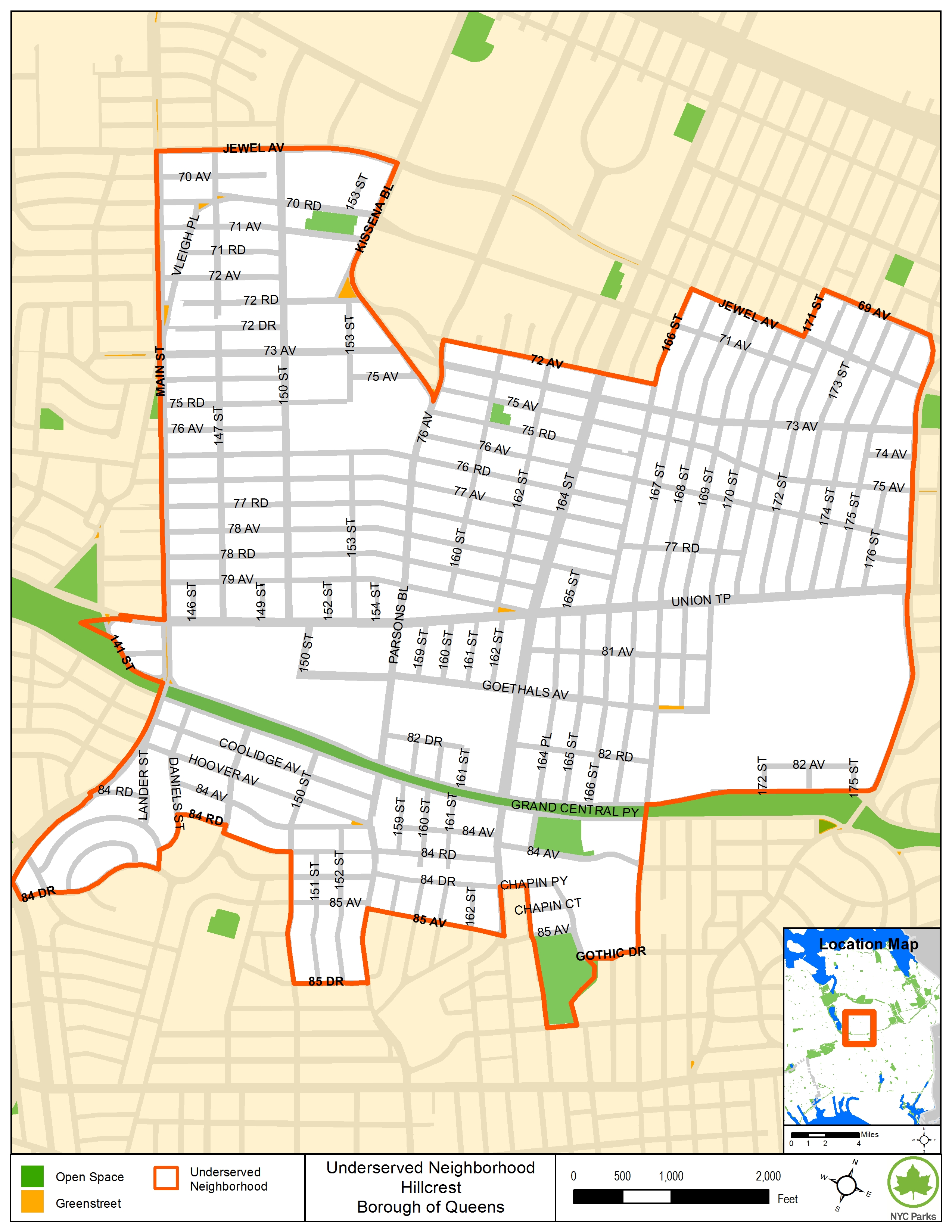
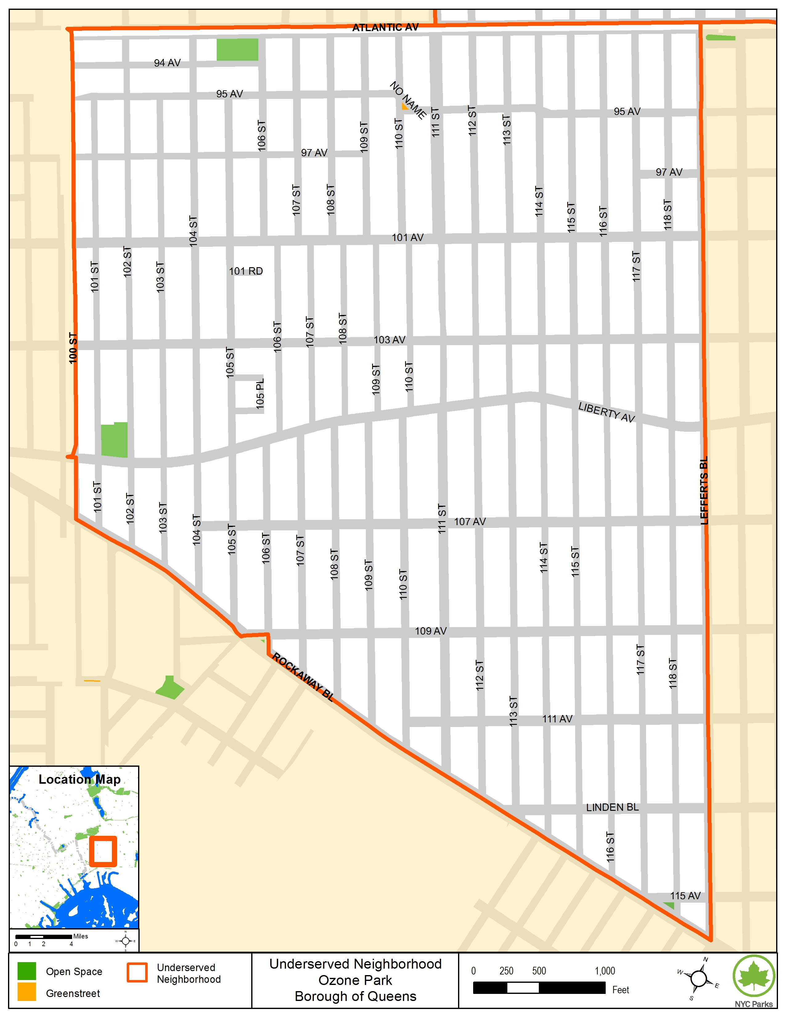
- *Underserved areas* are areas of high population density in the City that are generally the greatest distance from parkland where the amount of open space per 1000 residents is currently less than 2.5 acres.
- *Well-served areas*
- Have an open space ratio above 2.5 accounting for existing parks that contain developed recreational resources; or
- Are located within 0.25 mile (approximately a 10-minute walk) from developed and publicly accessible portions of regional parks.
For the methodologies used to identify underserved and well-served areas.
|
*Thresholds For Assessment:*
|
To view a map, click on a link in the table to see the specific area within a community district identified as underserved or well-served. Click here to return to the 2020 CEQR Technical Manual. To examine the underserved and well-served open space areas for another borough, click one of the following: Bronx, Brooklyn, Manhattan, or Staten Island.
2020 Technical Manual
Outdated – DO NOT USE
|
QUEENS |
|
Underserved Areas |
Well-Served Areas |
|
| Community District 1 | ||
| Community District 2 | ||
| Community District 3 | ||
| Community District 4 | ||
| Community District 5 | ||
| Community District 6 | ||
| Community District 7 |
Flushing Meadows/Corona Park |
|
| Community District 8 |
Cunningham Park |
|
| Community District 9 | ||
| Community District 10 | ||
| Community District 11 |
Alley Pond Park |
|
| Community District 12 | ||
| Community District 13 | ||
| Community District 14 |
|