
 Landmarks Preservation Commission311Search all NYC.gov websites


LPC celebrates nyc marathon with story map of landmarks along the route
The interactive story map highlights a selection of 50 landmarks and historic districts along the route in all five boroughs.
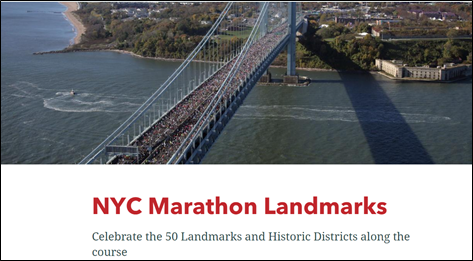
NEW YORK – The New York City Landmarks Preservation Commission (LPC) is celebrating the upcoming New York City Marathon with a story map of landmarks along the route. Released last year for the marathon’s 50th running, the NYC Marathon Landmarks story map highlights a selection of 50 landmarks and historic districts along the route in all five boroughs.
“The New York City Marathon is an awe-inspiring event that unites tens of thousands of athletes running for personal causes and personal bests and over a million spectators cheering them on all the way,” said Landmarks Preservation Commission Chair Sarah Carroll. “With this story map, we want to highlight many of the significant landmarks and historic districts along the way that represent the city’s diverse history and architectural highlights and offer incredible views connecting the runners and crowds to the city around them.”
LPC’s story map follows the marathon route from start to finish, identifying mile markers and the landmarks and historic districts on or near the course. From its extraordinary start on Staten Island to its dramatic finish in Central Park, the marathon winds through diverse and historic neighborhoods and past many designated landmarks. Along the route or visible from it are stone forts built before the Civil War, like Fort Tompkins and Fort Richmond on Staten Island; historic brownstone row house districts built to house the city’s rapidly growing population, like Fort Greene in Brooklyn, Hunters Point in Queens, Mott Haven in the Bronx, and Mount Morris Park in Manhattan; civic and institutional buildings like the New York State Supreme Court in Long Island City and the New York Public Library Harlem Branch; manufacturing and commercial buildings, like Somers Brothers Tinware Factory (later American Can Company) in Gowanus, which fueled the city’s economy; public parks and pools that provided places for recreation, like the McCarren Play Center; bridges that connected neighborhoods across rivers and canals, like the Queensboro Bridge, and of course the iconic skyscrapers like the Empire State Building that create the city’s famed skyline.
The NYC Marathon Landmarks story map, which is available online at tinyurl.com/marathonlandmarks, also includes such icons as the Statue of Liberty, notable markers along the route including the Williamsburg Savings Bank in Brooklyn and Central Park in Manhattan, and information on historic neighborhoods and their landmarks in all five boroughs. Users can simply scroll down to see each landmark along the route or navigate via the map to find specific highlights. Each landmark or historic district is illustrated with current and historic photographs, a brief summary, and a link to the designation report. To learn more about the TCS New York City Marathon, visit https://www.nyrr.org/tcsnycmarathon.
###
About the Landmarks Preservation Commission (LPC)
The Landmarks Preservation Commission is the mayoral agency responsible for protecting and preserving New York City’s architecturally, historically and culturally significant buildings and sites. Since its creation in 1965, LPC has granted landmark status to more than 37,500 buildings and sites, including 1,445 individual landmarks, 121 interior landmarks, 11 scenic landmarks, and 154 historic districts and extensions in all five boroughs. For more information, visit www.nyc.gov/landmarks and connect with us via www.facebook.com/NYCLandmarks and www.twitter.com/nyclandmarks.