
 Environmental Protection311Search all NYC.gov websites

Long-Term Control Plans

Gowanus Canal
Located in western Brooklyn, Gowanus Canal extends approximately 1.5 miles, from its northern terminus at Butler Street in the Boerum Hill section, to a line drawn between the western shoreline at Clinton Street and the eastern shore at 25th Street, beyond which the Canal opens into Gowanus Bay and ultimately to Upper New York Bay. The Canal has four short branches that historically served as “turning basins” to allow vessels to reverse direction. Gowanus Canal’s watershed is approximately 1,758 acres, of which 1,612 acres are served by combined sewers draining to either the Red Hook or to the Owls Head Wastewater Resource Recovery Facilities. There are a total of 11 combined sewer overflow (CSO) sites that can discharge to the Canal.
The present character of Gowanus Canal and its drainage area is considerably different than the character of its pre-urbanized condition. Originally a tidal creek winding through marshland, the waterbody was dredged, straightened and bulkheaded as the surrounding area was drained, urbanized and industrialized during the development of New York City. By 1870, the waterbody had been transformed to very near its present configuration, and Gowanus Canal was serving as a major industrial waterway through which materials were brought to and from the area industries. The surrounding area had been fully urbanized and industrialized, with sewage and industrial wastes discharging directly to the Canal without treatment, and the natural marshlands and freshwater streams had been replaced with combined sewers and storm drains. The urbanization of the surrounding drainage area resulted in an estimated three-fold increase in the annual runoff volume and a six-fold increase in the peak runoff rate to the waterbody. Stripped of the surrounding buffers of marshland and its natural freshwater flow, the waterbody was deprived of any natural response mechanisms that might have helped absorb the increased hydraulic and pollutant loads. The Canal’s limited circulation and exchange with New York Harbor waters allowed pollutants to build up within the Canal, and water quality deteriorated to such an extent that Gowanus Canal was notorious as a polluted waterway.
Superfund
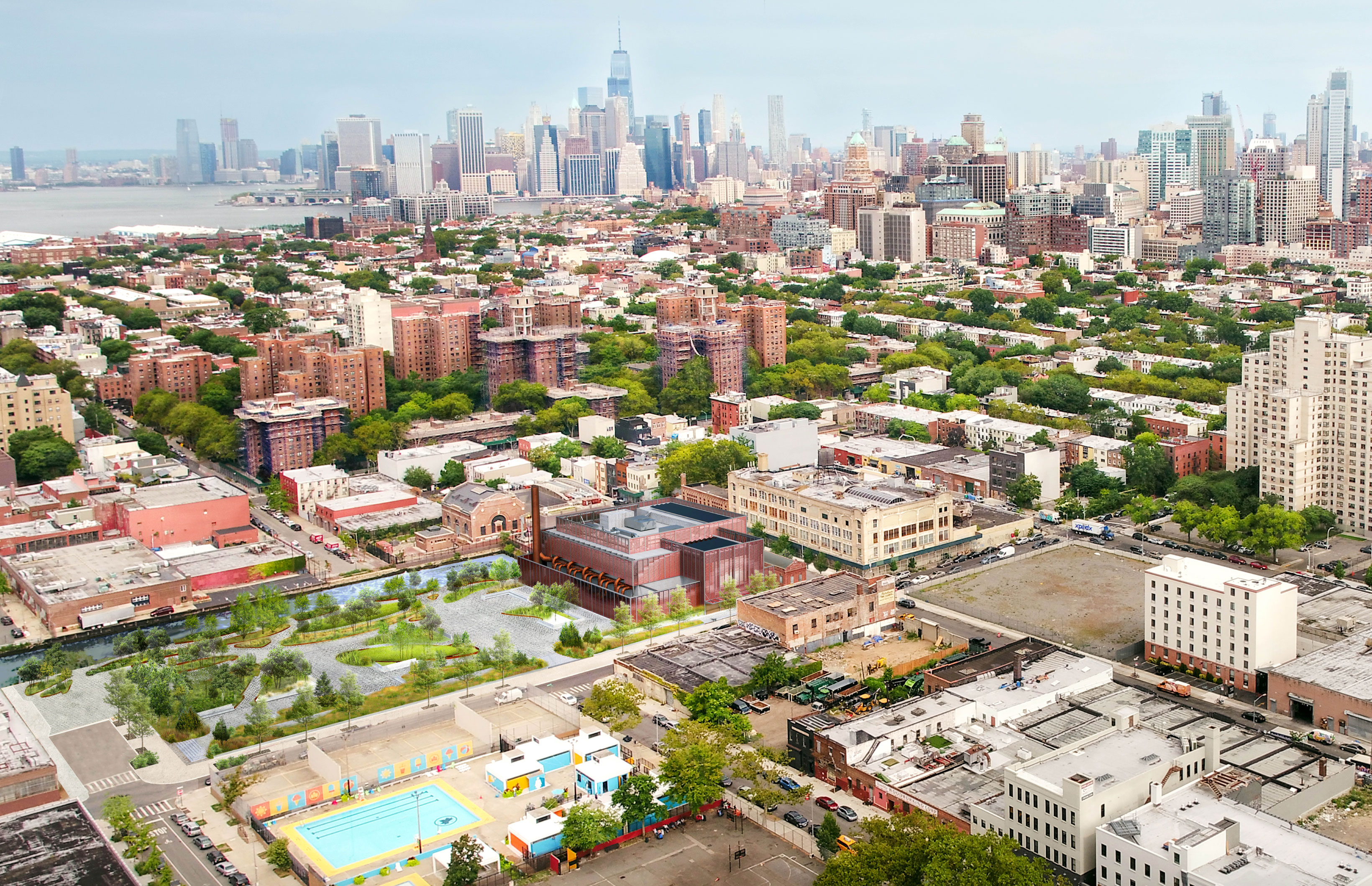
Gowanus CSO Red Hook—Rendered View of Proposed Aerial View in Context
In 2010, the United States Environmental Protection Agency (US EPA) designated the Gowanus Canal a Superfund site. The US EPA-led remediation of the Canal is underway with the dredging of contaminated sediment and capping of the canal bed. As a part of the US EPA’s Superfund Program for the Gowanus Canal, DEP will construct two combined sewer overflow tanks that will intercept and store up to 12 million gallons of combined sewage that would otherwise overflow into the Gowanus Canal during rainstorms. Learn more about combined sewer overflows and the New York City sewer system.
Red Hook Facility
Between Spring 2023 to Fall 2026, DEP’s contractors will be excavating and constructing the first of the two subsurface tanks, called the Red Hook facility. This tank will keep up to 8 million gallons of combined sewage out of the Canal during rainstorms, and will be constructed on the east side of the Gowanus Canal between Butler Street, Degraw Street and Nevins Street. The final phase of construction will include a facility head house and a 1.6-acre public waterfront open space atop the tank.
Working with the US EPA, DEP implemented robust community air monitoring and sampling programs to monitor emissions and protect residents and our workers while we undertake this important project.
- View Weekly Construction Look-Ahead Reports (December 2024 to present)
- View Daily Air Sampling Data (November 2024–present)
- View Daily Air Monitoring Reports (from mid-October 2023 to present)
- View Weekly Air Monitoring Reports (from April to mid-October 2023)
- View Soil Sampling Analysis
- View Air Sampling Results (February 15–June 19)
- View US EPA 9/24/24 Presentation of Air Sampling Results (June 27–July 23)
- View US EPA 12/10/24 Community Update Presentation
- View DEP 12/10/24 Community Update Presentation
For questions or concerns about the Red Hook Facility construction project, please contact the Community Construction Liaison, Laura Shaffer, at gowanusccl@johnson-asberry.com or 934-216-0209.
Construction Advisories
- DEP Completes Major Phase of Construction in Building Underground Tank to Protect Gowanus Canal from Pollution
- Construction Advisory—August 1, 2024
- Construction Advisory—January 22, 2024
- Construction Advisory—November 27, 2023
- Construction Advisory—September 12, 2023
Owls Head Facility
Spring 2024 to Summer 2027, DEP’s contractors will be excavating and constructing the second of the two subsurface tanks, called the Owls Head facility. This tank will keep up to 4 million gallons of combined sewage out of the Canal during rainstorms. The project site is located at the bend of the Canal at 2nd Avenue and 6th Street within the Industrial Business Zone. The project will also relocate NYC Department of Sanitation (DSNY) facilities and create 2-acres of public waterfront open space.
Working with the US EPA, DEP implemented a robust community air monitoring program to monitor emissions and protect residents and our workers while we undertake this important project.
For questions or concerns about the Owls Head Facility construction project, please contact the Community Construction Liaisons:
- Taylor Harrington, 513-652-3772, GowanusCCL_OH@mbakerintl.com
- Parneet Kaur, 718-952-4781, Gowanus.OH.CSO.Project@gmail.com
Construction Advisories
Long Term Control Plan
DEP completed a Long Term Control Plan (LTCP) to better understand combined sewer overflow (CSO) impacts on water quality within Gowanus Canal. Throughout the LTCP’s development the City collected water quality data, performed extensive modeling, held multiple public meeting and analyzed potential projects based on costs and anticipated water quality. To learn more about the Gowanus Canal LTCP and other improvement projects, download Gowanus Canal: Improving Water Quality by Reducing Impacts of Combined Sewer Overflows.
The Gowanus Canal LTCP was submitted in June 2015. The New York State Department of Environmental Conservation (DEC) approved the plan on March 29, 2017.
Public Meetings
Gowanus Canal LTCP Kickoff Meeting
November 19, 2014 – PS 32, Brooklyn
- Gowanus Canal Kickoff Meeting Advertisement
- Gowanus Canal Kickoff Meeting Presentation
- Gowanus Canal Kickoff Meeting Summary
Gowanus Canal LTCP Public Meeting 2
May 14, 2015 - PS 32, Brooklyn
- Gowanus Canal 2nd Meeting Advertisement
- Gowanus Canal 2nd Meeting Presentation
- Gowanus Canal 2nd Meeting Summary