 Brooklyn Community Board 18311
 Search all NYC.gov websites
Maps
District Profile
This map shows the District Profile of Brooklyn Community Board18 as recorded by the NYC Department of City Planning. This map contains information for the Total Population, Vital Statistics, Income Support, Total Lan Area, and Land Use Support categorized by year. To view more maps and data about Brooklyn CB 18, please visit BKCB18’s Community Profile.

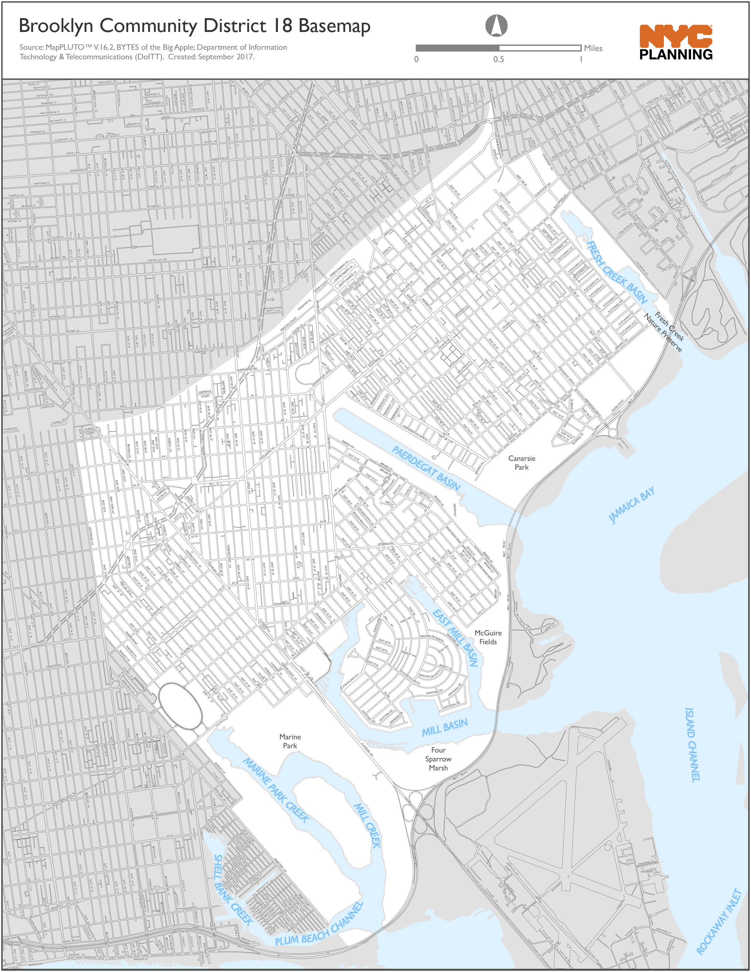
Community District Base Map
This is a map of boundaries within District 18 as recorded by the NYC Department of City Planning. To view more maps and data about this community board, please visit BKCB18’s Community Profile.
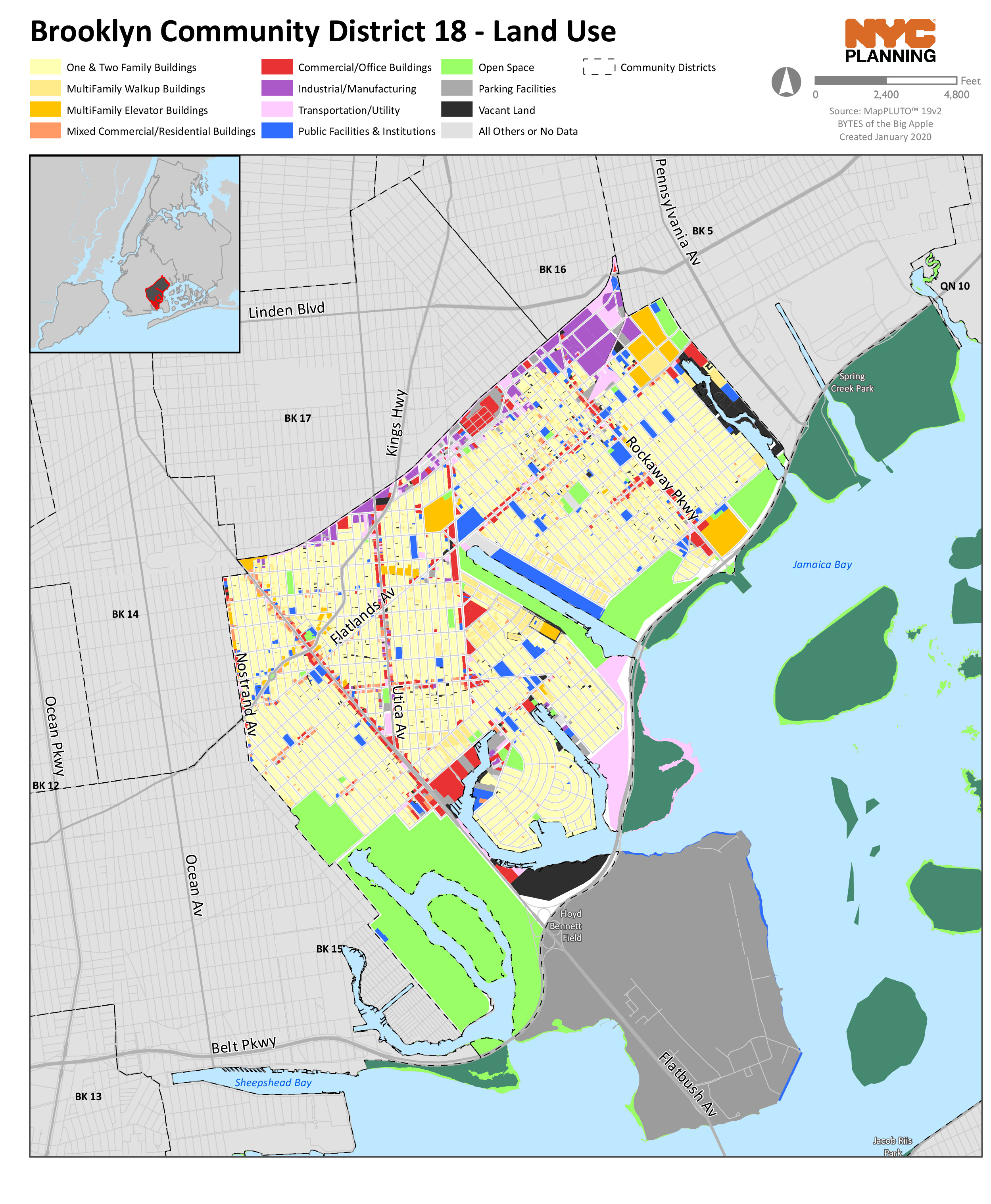
Land Use Map
This Land Use chart provides total lot area by land use type according to the NYC Department of Finance lot measurements. To view the percentages by land use type, please visit BKCB18’s Community Profile

NYCityMap
NYCityMap provides information including the locations of schools, day care centers, senior centers, libraries, hospitals, subways, and other facilities. This page is also the point to the numerous location-based applications on NYC.gov such as online property, building, statistics, and census information.
View this Community District 18 on NYCityMap
View more maps and data at the Department of City Planning’s Website


